Myths of Rathcroghan
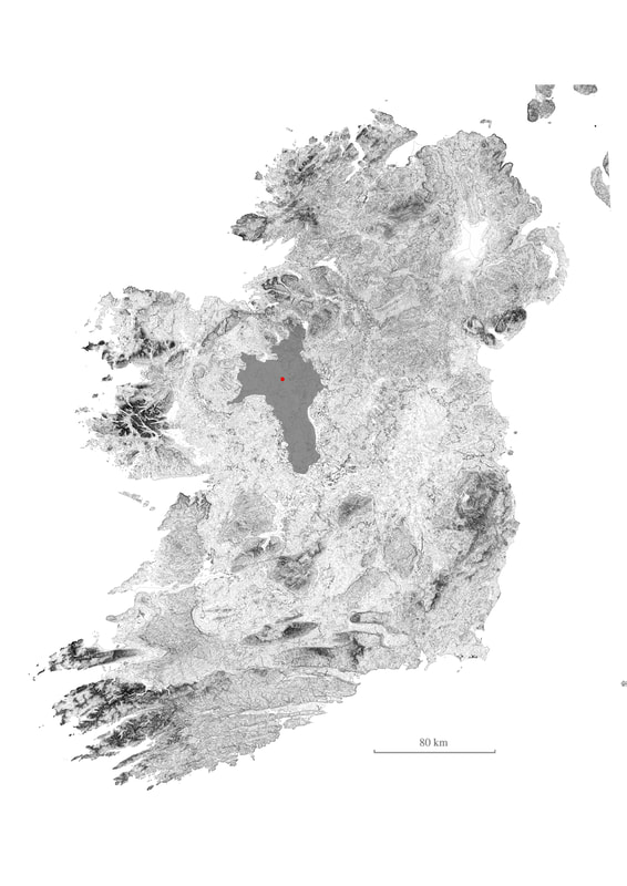
"Rathcroghan is the oldeset and largest unexcavated Royal Site in Europe"
With the Oweynagcat Cave being the origin of Halloween, and the area being the starting and ending point of the infamous tale of An Táin, Rathcroghan is a very important location in Irish Mythology. Additional legends include Táin Bó Flidas, Táin Bó Fraoch, and many more. Several of the monuments have tales associated, and are extremely important on a national and international scale. |
|
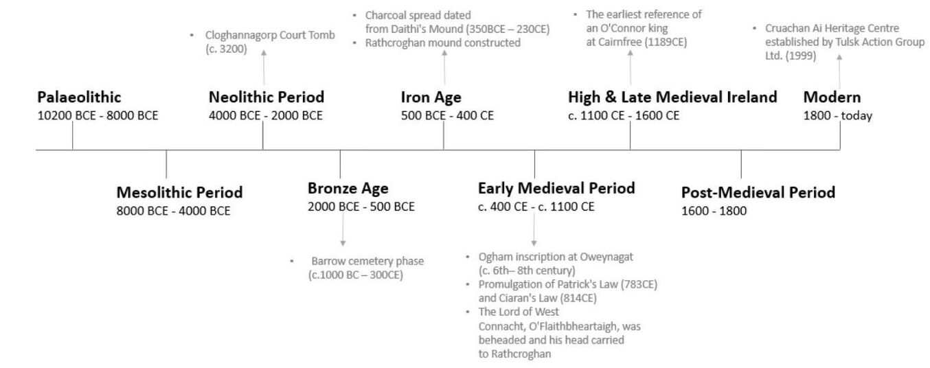
History of Rathcroghan |
|
Farming Rathcroghan
"The sites are located in largely intact pastoral landscapes, which have contributed to the retention of a unique sense of place, spirit and feeling."
With evidence of agriculture on this landscape dating back over 6,000 years, farming is an integral part of the land. Without the constant grazing of cattle, large plants would have grown and caused significant damage to the monuments. Only 60 of 240 monuments are in state care, with the others on private pastoral land. Issues of public access, safety, conservation challanges, lack of recognition towards the farmers work, and local socio-economic decline are the primary problems which evolved my project.
With evidence of agriculture on this landscape dating back over 6,000 years, farming is an integral part of the land. Without the constant grazing of cattle, large plants would have grown and caused significant damage to the monuments. Only 60 of 240 monuments are in state care, with the others on private pastoral land. Issues of public access, safety, conservation challanges, lack of recognition towards the farmers work, and local socio-economic decline are the primary problems which evolved my project.
|
"in mapping, one objective is to discover (by seeing) meaningful physical and intellectual shape organizations in the milieu, structures that are likely to remain hidden until they have been mapped... plotting out or mapping is a method for searching for such meaningful designs."
Denis Cosgrove, 1999, p.229 |
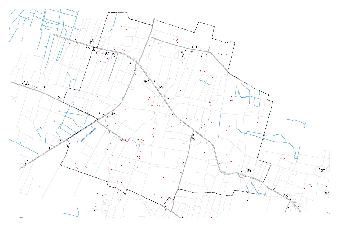
Digital Rathcroghan Map
|
The project relied heavily on understanding the existing landscape, before making informed design decisions. This required intense research of the myths and agricultural history of Rathcroghan, which involved mapping exercises, as well as standard good practice in these fields. Using mapping as a means to "construct the unconscious" (Cosgrove, 1999) proved to be an efficient means of understanding the landscape's evolution as well as its ongoing activities.
The initial map outlined the greater Rathcroghan area (left). We paid particular attention to the monument locations, which are represented by red dots, as they are on Geohive. However, these mere dots felt dismissive of their physical presence and scale, which was when I began to draw by hand.
|
Marks on the Landscape
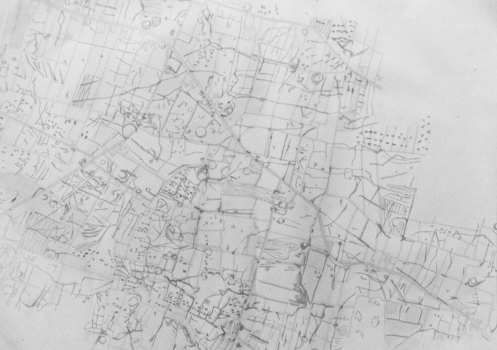
To investigate in a thought provoking manner, I explored "drawing as a way of telling" (Ingold). Graphite, ink and charcoal allowed me to communicate the transcendent and dynamic aspects of the site. The physical build-up of materials also felt reminiscent of the prehistoric labour of Rathcroghans Neolithic construction.
To choose a territory to evaluate, I began by mapping the Rathcroghan area showing the prominent marks on the landscape (above). The marks are varied in nature - from agricultural, geological and archaeological - but all equally represented, much like the approach of an archaeologist. This drawing aided me in selecting a central 270 hectare territory due to its intriguing marks which emphasise its significant history.
To choose a territory to evaluate, I began by mapping the Rathcroghan area showing the prominent marks on the landscape (above). The marks are varied in nature - from agricultural, geological and archaeological - but all equally represented, much like the approach of an archaeologist. This drawing aided me in selecting a central 270 hectare territory due to its intriguing marks which emphasise its significant history.
Locating the Interventions
|
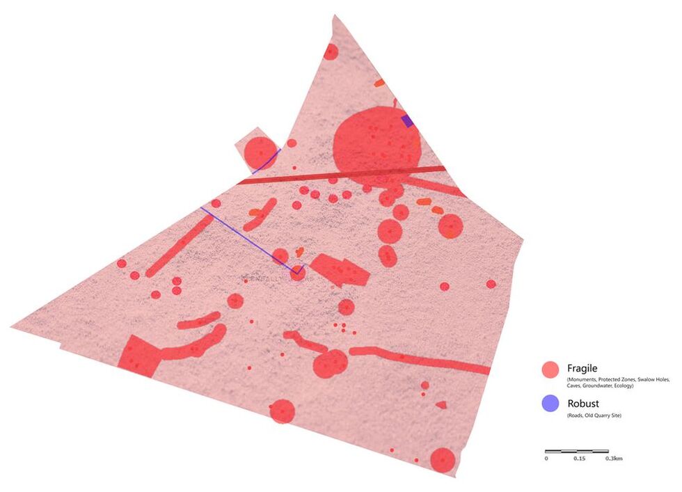
Inspired by Ian McHerg's approach to landscape, I developed a 'Fragile versus Robust' map, which highlights the weaker points (such as monuments or flooding zones) and the stronger points (such as the old quarry site, or existing roads), in order to evaluate where is more appropriate for architectural intervention.
However, it is worth noting that no matter where construction is proposed on this landscape, great consideration is needed due to the potential of artefacts lurking beneath the surface. |
|
Additional Analysis Work
Further investigative drawings are seen below. Beyond researching the site itself, further exploration of other locations were obtained. This meant evaluating the standard practices of Irish farming (along with more modern environmental considerations) as well as mythological sites. This lead to a greater understanding of the pragmatic aspect of the scheme, and how land management would be a key consideration for a resolved proposal of this landscape.
Primary Research Sources |
|
|
|

|

|
